Satellites and drones are reshaping Michigan agriculture by revealing subtle field and ecosystem patterns that traditional observation methods miss. Using high resolution remote sensing and aerial platforms, Michigan farmers and conservationists can now manage soils, nutrients, water, and habitats with pinpoint accuracy.
What Is Precision Agriculture and Precision Conservation?

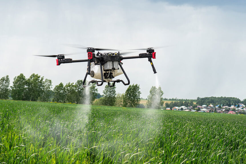
An industrial drone flies over a green field and sprays useful pesticides to increase productivity and destroys harmful insects.
Precision agriculture uses technologies like GPS, sensors, satellite imagery, and drones to monitor field variability and apply inputs variably instead of uniformly. Modern farms deploy yield monitors, GIS systems, and remote sensing tools to partition fields into management zones and optimize inputs accordingly.
Precision conservation is a related concept. It uses the same data rich approaches but shifts focus from yield maximization alone to combining productivity with ecological fortification. Rather than treating all land uniformly, precision conservation identifies chronically underperforming areas or fragile zones and repurposes them for habitat, pollinators, buffer strips, or other ecological benefits, saving on inputs and protecting environment simultaneously.
Michigan as a Testing Ground
In Michigan, especially in the Midwest’s Corn Belt region, farmers and researchers are experimenting at scale. One demonstration at Sandborn Farms in Portland, Michigan has drawn attention. Drones spray fertilizer variably across cornfields, skipping zones where further input would be wasteful, and designating weak yielding areas for ecological use instead of continuous cropping.

An agricultural drone sprays pesticide on green crop field.
Drones carrying fertilizer or pesticides now fly low over field sections, guided by maps derived from satellite and ground sensor data. That means applying extra nutrients only where they will be productive and holding back elsewhere, avoiding both cost waste and environmental harm.
The push is strong. In Michigan, the use of agricultural drones, including for spraying, has grown sharply since the state legalized drone based spraying about four years ago. Researchers highlight that drones enable precision in addressing pest problems or nutrient deficits only where needed, reducing chemical use and preserving yield.
Crop Types and Use Cases in Michigan
- Corn and potatoes are among the leading applications for drone spraying in Michigan.
- Cherry orchards benefit from aerial platforms too. Spraying drones can reach upper canopy zones that ground sprayers struggle with and target early stage fungal threats.
- Weed spotting and mapping. Drones and satellite imagery help detect weed infestations by spectral differences and direct herbicide only where needed.
- Soil moisture and stress mapping. Remote sensing helps identify zones under water stress or nutrient deficiency before visible damage sets in.
How the Technology Works Together

Agricultural drone spraying row crops.
At the heart of this transformation is remote sensing. It captures light, reflectance, thermal, multispectral, and hyperspectral data from satellites or drones, and then interprets it using algorithms, AI, and GIS tools.
Satellites provide large area, periodic coverage with repeat revisit times that help track seasonal changes, plant stress, moisture trends, and broader spatial patterns. Drone platforms fill the gap in resolution and flexibility by flying more frequently, zooming in, and responding to local anomalies. The synergy of both gives a layered, multi scale view.
Once data are collected, machine learning and analytics generate field maps that highlight zones of high yield potential, low productivity, erosion risk, moisture deficiency, or nutrient imbalance. Based on that, prescription maps are built. Then drones or variable rate applicators apply seed, fertilizer, or pesticide exactly where needed, not everywhere.
Economic, Environmental and Operational Benefits
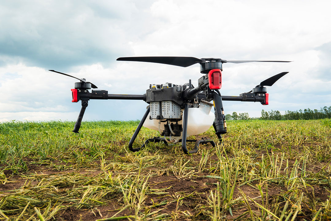
An agricultural drone sits at rest on a farm.
From an economic standpoint, the savings can be significant. Rather than blanket applying expensive inputs to entire fields, farmers can cut costs in areas that historically underperform, areas where extra inputs rarely yield returns. In effect, they redirect capital to where it truly pays off.
Environmentally, the benefits are compelling. Excess nitrogen, if not taken up by plants, can escape into the atmosphere as nitrous oxide, a potent greenhouse gas, or leach into waterways, fueling algae blooms and contaminating groundwater. Precision input control helps reduce those leakages.
Operationally, drones offer advantages too. They fly above wet or muddy fields, avoiding compaction damage by avoiding tractors traveling across soil. Their speed, agility, and precision reduce time wasted in large field scouting.
Path Forward: Scaling, Collaboration and Policy Support
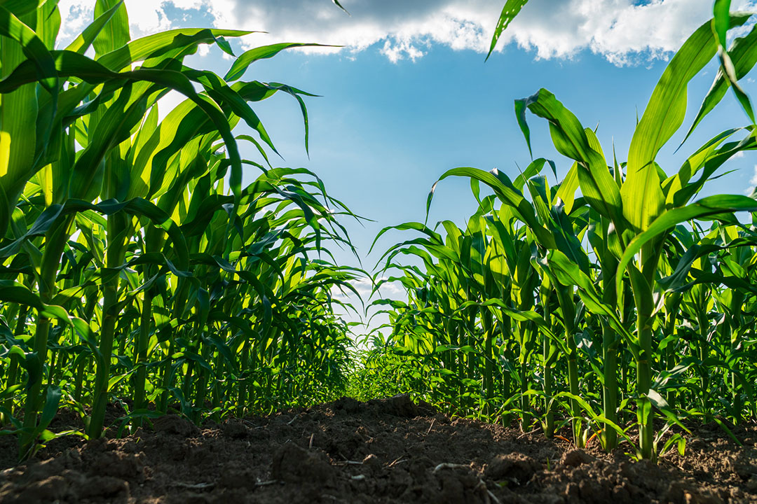
Tall corn stalks stretch towards a clear blue sky, thriving in fertile soil.
Research partnerships with institutions like Michigan State University are proving crucial to this evolution. Agronomists, ecologists, and engineers work together to co design prescriptions and field trials, which leads to iteratively better results.
Strategic policy levers can also accelerate adoption. This includes creating incentives or cost share programs for farmers to adopt precision tools, offering subsidies for drone services in underserved areas, and enacting regulatory reforms that safely relax beyond visual line of sight flight limits.
Ultimately, this technology enables a broader vision. At the ecosystem scale, precision conservation planning can surgically link isolated habitat patches into functional corridors, buffer vulnerable streams, and restore natural areas with newfound efficiency. This approach delivers profound ecological benefits that were once hidden in plain sight, promising a future for Michigan agriculture that is both productive and sustainable.
Bring Precision to Your Farm with Fair Lifts

Fair Lifts Unmanned Aerial Services team on site.
Ready to put these insights to work on your land? The team at Fair Lifts is here to help you implement these precise and profitable strategies. We specialize in the very applications outlined above, from detailed field mapping and variable rate spraying to identifying underperforming areas for potential conservation.
Contact Fair Lifts Unmanned Aerial Services today at 1-800-318-8940 to see how our data driven drone services can cut your costs, boost your yields, and enhance your environmental stewardship.