Revolutionizing Agriculture with Advanced Aerial Surveys
In the ever-evolving world of agriculture, staying ahead means embracing innovative solutions that drive efficiency and productivity. At Fair Lifts, we understand the unique challenges faced by farmers and agronomists, and we're here to offer a game-changing solution: advanced hi-res multispectral drone aerial surveys.
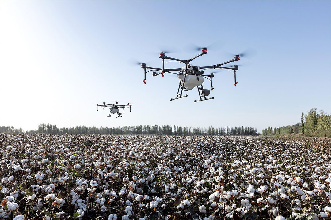
Our state-of-the-art multispectral drones are designed to capture detailed, high-resolution images that provide a comprehensive view of your crops. These images, when processed, reveal vital information about plant health, soil quality, and potential problem areas, allowing for timely interventions and informed decision-making. Whether you're looking to monitor crop health, assess damage after a storm, or optimize irrigation, our drones deliver insights that are both deep and actionable.
Operating across North America, Fair Lifts is committed to providing agricultural professionals with the best in aerial survey technology. Our team is fully licensed and insured, ensuring that every project is executed with the utmost professionalism and safety in mind. Plus, with multi-year contract discounts and dedicated project managers on hand, we're not just a service provider; we're a partner in your agricultural success.
Embrace the future of farming with Fair Lifts. Let our advanced multispectral drones illuminate the path to greater yields, healthier crops, and a more sustainable agricultural future.
The Advantages of Fair Lifts Multispectral Drones in Agriculture

Revolutionizing Agriculture with Advanced Aerial Surveys
In the dynamic realm of agriculture, the integration of technology has always been the key to unlocking new horizons. Among the most transformative technologies in recent years are drones, especially when it comes to multispectral imaging. Fair Lifts, with its commitment to innovation and excellence, stands at the forefront of this revolution, offering unparalleled agricultural drone services. Let's delve into the multifaceted advantages of employing our state-of-the-art multispectral drones for your agricultural needs.
• Bird's Eye View: Obtain an unparalleled aerial perspective, allowing for comprehensive monitoring of vast stretches of land, ensuring no area goes unchecked.
• Precision Mapping: High-resolution images provide a detailed analysis of the terrain, revealing variations in soil health, moisture levels, and crop conditions.
• Early Detection: Identify potential challenges, such as pest infestations, disease outbreaks, or nutrient deficiencies, before they escalate, ensuring timely interventions.
• Data-Driven Insights: Multispectral imaging captures data beyond what the human eye can see, offering insights into plant health, chlorophyll levels, and water stress, among others.
• Optimized Irrigation: Identify areas of overwatering or underwatering, allowing for more efficient water resource management and healthier crops.
• Yield Estimation: Predict crop yields with greater accuracy by analyzing the health and vigor of plants throughout the growing season.
• Time and Cost Efficiency: Traditional ground-based surveys are time-consuming and labor-intensive. Drones can cover large areas quickly, reducing the time and cost of data collection.
• Safety and Compliance: Fair Lifts ensures all drone operations adhere to safety and regulatory standards, with pilots that are rigorously trained and certified.
• Historical Data Comparison: Track changes and trends over time by comparing current data with historical drone surveys, aiding in long-term farm management strategies.
• Customized Reporting: Tailored reports based on the specific needs of each farm, ensuring actionable insights that can be directly implemented.
• Environmental Monitoring: Assess the impact of farming practices on the surrounding environment, ensuring sustainable and eco-friendly operations.
The integration of multispectral drones in agriculture is a game-changer, offering a depth of insights previously unimaginable. With Fair Lifts' advanced drone technology, farmers and agronomists can make informed decisions, optimize resources, and maximize yields. Don't miss out on the future of precision agriculture. Contact Fair Lifts today for a free quote and take your farming operations to the next level!
The Power of Multispectral Crop Analysis: A Drone's Eye View
In the heart of a sprawling farm, as dawn breaks, a farmer gazes across his fields. The vast expanse of green seems uniform, but beneath this verdant blanket, myriad stories unfold. Some plants thrive, while others struggle, silently signaling for attention. But how does one discern these subtle cries amidst the overwhelming chorus of nature?
Enter multispectral crop analysis, a revolutionary technique that's transforming the agricultural landscape. At its core, this method captures data beyond the visible spectrum, unveiling a world teeming with information. While our eyes might see a uniform field, multispectral imaging discerns variations in plant health, chlorophyll levels, and water stress. It's like having a superpower, one that reveals the hidden tales of every plant.
Now, imagine combining this superpower with the agility and precision of drones. Fair Lifts has done just that. Our advanced aerial survey drones, equipped with high-resolution multispectral cameras, soar above fields, capturing data that's both detailed and expansive. This bird's eye view, combined with the depth of multispectral imaging, offers insights that are transformative.
For instance, areas that appear healthy to the naked eye might be silently battling pests, pathogens, or irrigation issues. With traditional methods, by the time these problems manifest visibly, the damage is often extensive. However, with our drone-enabled multispectral analysis, early warning signs are detected, allowing for timely interventions.
Moreover, the data isn't just about identifying problems. It's a treasure trove of insights that can guide a farmer's every decision. From optimizing irrigation based on precise moisture levels to generating variable rate prescriptions that align with soil health, the possibilities are vast.
But what truly sets Fair Lifts apart is our commitment to making this technology accessible and actionable. Our processed imagery is intuitive, color-coded, and overlaid on familiar platforms like Google Earth. Green indicates healthy areas, while colors like red pinpoint potential issues. This visual simplicity, backed by deep data, ensures that farmers can act swiftly, focusing their attention where it's needed most.
In essence, our multispectral drone services are more than just a technological marvel; they're a bridge between farmers and their land, fostering a deeper understanding and a more harmonious relationship. It's not just about growing crops; it's about nurturing them, understanding their stories, and ensuring they thrive.
In the world of agriculture, where every decision can impact the yield, multispectral crop analysis with drones is the ally every farmer needs. It's the difference between seeing and understanding, between reacting and anticipating. With Fair Lifts, embrace this future and ensure your crops not only grow but flourish. Call us at 1-800-913-6124 and let's embark on this journey of discovery together.
Revolutionizing Field Management with Drone Mapping

Advanced Drone Field Mapping and Analysis
In the vast expanse of agriculture, understanding every inch of your field is crucial. Traditional methods, while reliable, often lack the precision, speed, and comprehensiveness that modern farming demands. This is where drone mapping steps in, offering a transformative approach to field management.
Here's how Fair Lifts is redefining the landscape with our advanced drone mapping services:
-
Fast Results: Time is of the essence in agriculture. With our advanced technology, we can create detailed maps of your fields rapidly, often on the same day, without the need for an internet connection. This speed ensures faster decision-making and immediate action, keeping you ahead of potential challenges.
-
Accurate Maps: Our drones capture high-resolution imagery, ensuring detailed and accurate maps of fields and crops at any growth stage. With the integration of RGB & Multispectral drone data processing and RTK support, the accuracy of our maps is unparalleled.
-
Trusted Results: Say goodbye to guesswork. By analyzing our crop health maps, you can gain insights into the well-being of your plants. Whether it's calibrated multispectral images or full-resolution RGB images, the clarity and detail we provide ensure informed decisions every time.
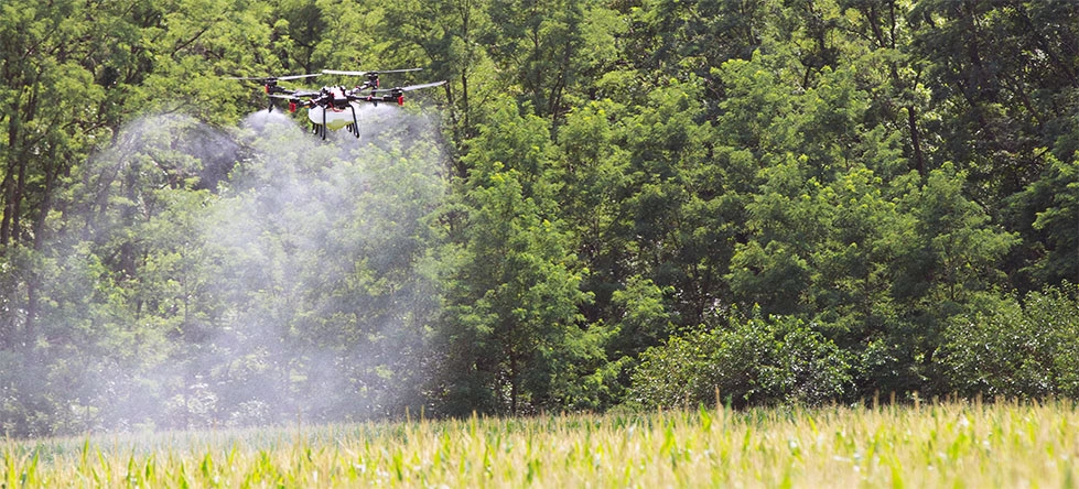
Prescription Maps: Tailored strategies are the future of farming. Our prescription maps, designed for Fertilizer, Growth Regulator, and Crop Protection, are compatible with a range of equipment, from tractors and sprayers to our very own Fair Lifts Agriculture Spraydrones.
-
Easy Sharing: Collaboration is key in agriculture. With Fair Lifts, sharing your data becomes a breeze. Whether you prefer a comprehensive PDF report or industry-standard formats, we've got you covered.
Beyond these offerings, drone mapping brings a host of additional benefits. It aids in soil health analysis, irrigation planning, and yield prediction. It can also assist in monitoring and managing potential threats like pests or diseases. In essence, drone mapping is not just a tool; it's a comprehensive solution, ensuring that every decision you make is backed by data, precision, and expertise.
Embrace the future of field management with Fair Lifts' drone mapping services. With precision, speed, and a wealth of insights at your fingertips, ensure that your fields not only thrive but flourish. Reach out to us today and discover the transformative potential of drone mapping in agriculture.
Unlock the Future of Precision Agriculture with Fair Lifts
In the ever-evolving world of agriculture, staying ahead is not just an advantage; it's a necessity. At Fair Lifts, we're not just offering a service; we're offering a partnership. A partnership that brings with it the promise of cutting-edge technology, unparalleled expertise, and an unwavering commitment to your success.
Why Choose Fair Lifts?
-
Unmatched Safety: Your peace of mind is paramount to us. That's why we carry a staggering $5,000,000.00 in aircraft liability insurance, ensuring that our clients are always protected.
-
Dedicated Support: Our team of dedicated project managers is your direct link to us. They handle all communication, ensuring that your queries are addressed promptly and your needs are always met.
-
Proudly American: In a globalized world, we take immense pride in offering drones and support equipment that are made right here in the USA. Quality, reliability, and excellence are the hallmarks of our equipment.
-
Data Security: In an age where data is gold, we understand the importance of protecting it. Our sincere concern about safeguarding our client’s data ensures that your information remains confidential, secure, and in trusted hands.
Your Farm. Our Technology. A Brighter Future.
The fusion of your expertise and our technology can redefine the boundaries of what's possible in agriculture. Whether it's optimizing yields, conserving resources, or simply gaining a deeper understanding of your land, we're here to make it happen.
Take the Next Step
The future of precision agriculture is waiting, and with Fair Lifts, it's within your grasp. Don't let this opportunity pass by. Reach out to us today, and let's chart a course towards a more prosperous, sustainable, and efficient farming future.
Contact Fair Lifts now for a free quote and embrace the future of farming!
Drone News and Articles
Agricultural Drones for Next Generation Farmers: Transforming Modern Agriculture
Why Agricultural Drone Spraying Is Becoming a Mainstay in Precision Agriculture

Drone Fungicide Application: Key Advantages for V10 Corn
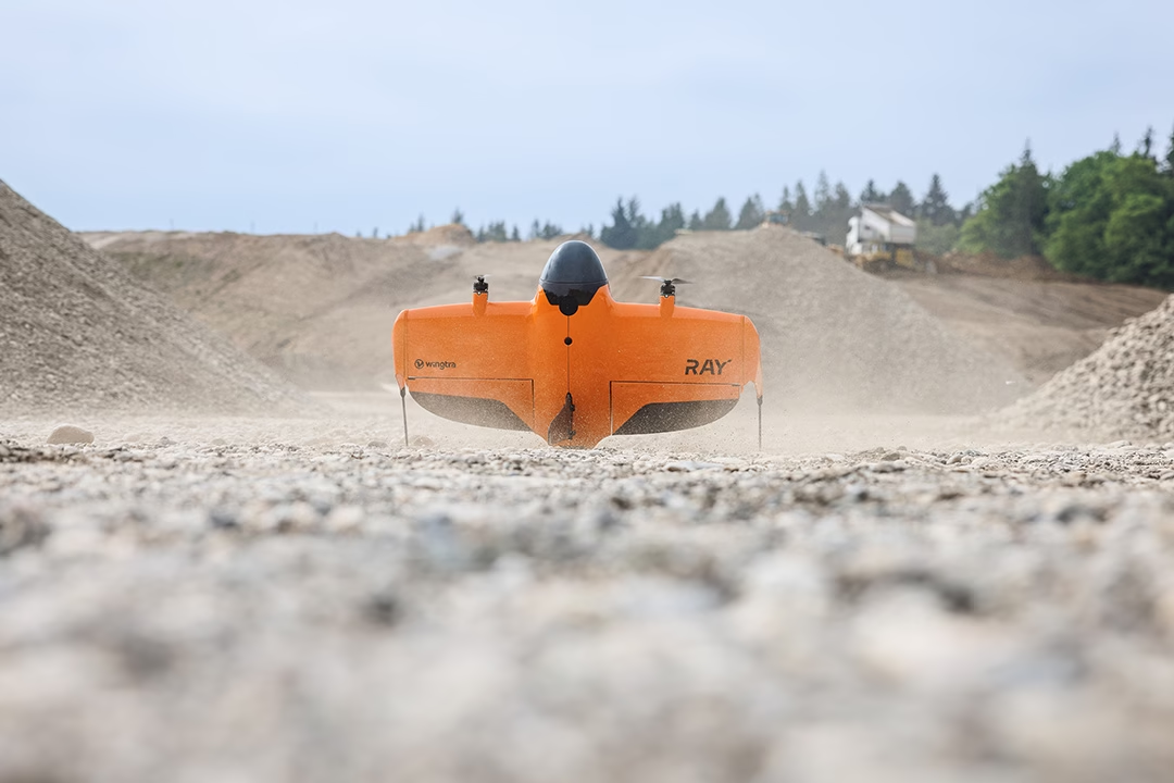
Wingtra and Trimble Partner to Transform Drone Surveying Workflows