Unlock Hidden Insights with Aerial Thermal Imaging
When traditional inspection methods are not enough, helicopter-based thermal imaging provides a safe and efficient way to gather critical information from the air. Fair Lifts coordinates access to advanced aerial thermal survey services that capture high-resolution data across wide areas. These surveys reveal temperature variations and hidden patterns that are essential for identifying inefficiencies, assessing environmental impact, and maintaining infrastructure integrity.
Fair Lifts works with a network of trusted partners who operate aircraft equipped with state-of-the-art thermal imaging systems. These sensors detect subtle heat differences across terrain, buildings, and vegetation, offering a detailed perspective that cannot be achieved from the ground. Whether used for energy audits, agricultural analysis, wildlife monitoring, or land management, thermal imaging by helicopter delivers fast, accurate, and actionable results.
With careful coordination and reliable technology, Fair Lifts helps clients gain a clearer understanding of their environment and make informed decisions based on dependable aerial data.
Precision Thermal Imaging from the Air
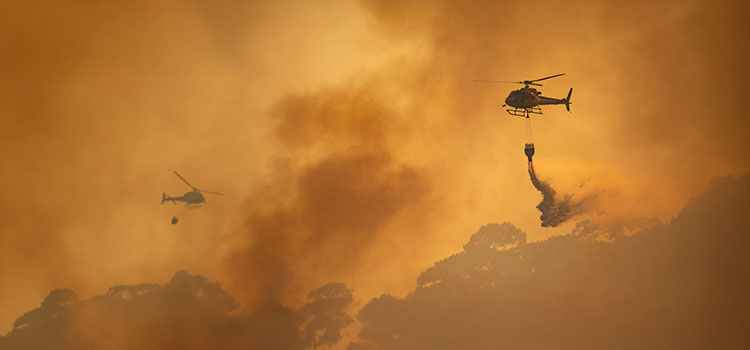
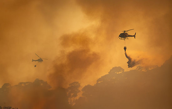
Fire Management
Thermal cameras detect heat through smoke, haze, and darkness, allowing operators to locate active hotspots and verify that fires are fully contained. This technology is used to support firefighting efforts, ensuring safer and more effective suppression strategies.
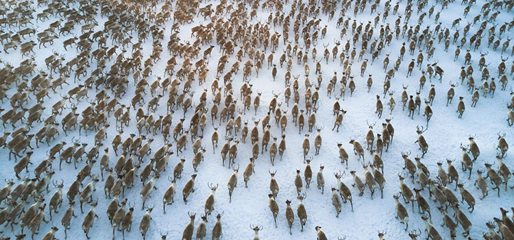
Environmental Monitoring
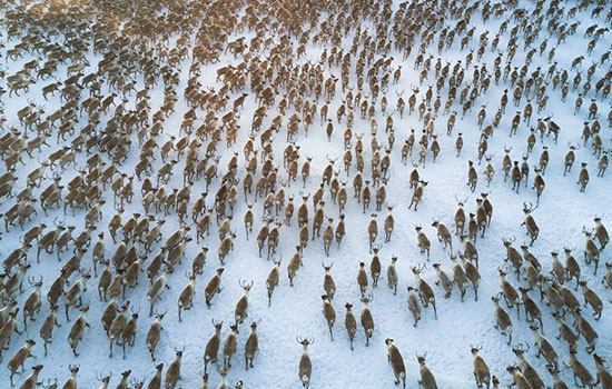
Thermal imaging provides a non-intrusive method of observing wildlife and identifying environmental issues. It can detect hidden animals without disturbing their habitats and help locate sources of runoff or pollution in waterways. These insights assist researchers and environmental agencies in protecting sensitive ecosystems.


Agricultural & Land Data Collection
Helicopter-based thermal surveys reveal variations in soil moisture, drainage, and irrigation efficiency. This data helps farmers and land managers make informed decisions about crop management, resource use, and conservation planning.


Structural & Infrastructure Inspection
Thermal imaging is an effective tool for identifying insulation deficiencies, HVAC issues, and other areas of energy loss in buildings and industrial facilities. By pinpointing heat leaks or mechanical problems, property owners and developers can improve efficiency and reduce operational costs.
How Fair Lifts Thermal Imaging Works
Fair Lifts coordinates aerial thermal imaging missions using reliable helicopter platforms and advanced infrared technology to deliver clear, accurate, and actionable data. Each mission is carefully planned to ensure that environmental conditions and equipment configurations support the most effective thermal readings possible.
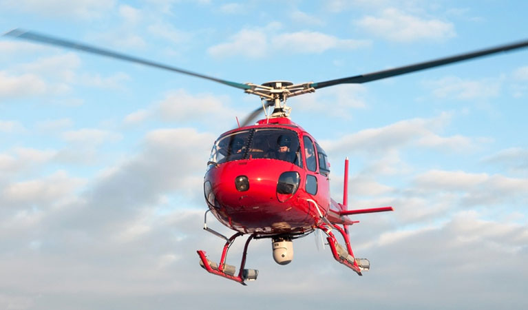
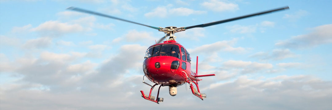
Helicopter Platforms: Thermal imaging surveys are typically carried out using light and versatile helicopters such as the Bell 206B and Airbus H125 (AS350). These aircraft are well suited for both urban and remote environments, offering stability, maneuverability, and the ability to hover precisely over target areas. Their compact size allows access to locations that are often difficult for larger aircraft to reach, ensuring detailed and efficient data collection.
Data Capture and Imaging Process: Once in position, the aircraft is equipped with thermal imaging sensors that measure temperature variations across surfaces or terrain. The sensors record subtle differences in heat retention and emission, which are translated into visual data using specialized software. For example, a roof with poor insulation will retain heat differently than surrounding areas, appearing in contrasting colors on a thermal image. Collected data is reviewed and processed in real time, then securely stored and transferred to cloud-based systems for further analysis. Clients gain access to detailed thermographic reports that help identify heat loss, water intrusion, or mechanical issues before they escalate into costly repairs.
Environmental and Operational Considerations: Optimal conditions for aerial thermal imaging include calm wind speeds, clear skies, and stable surface temperatures. Surveys are often scheduled for early morning or late evening, when temperature contrasts between surfaces are most pronounced. These planning factors help ensure accurate and consistent imaging results.
The Science Behind Thermal Imaging: All objects emit infrared radiation as a function of their temperature. Thermal imaging sensors detect these energy variations and convert them into visible patterns that reveal differences in heat distribution. Rather than capturing a single image, the system records a continuous stream of thermal data, creating a dynamic visual map of temperature changes across the target area.
Fair Lifts works with experienced aviation partners who use this data to deliver high-quality thermal imaging results for a range of applications, from structural inspections and fire monitoring to agricultural and environmental assessments.
Managing Valuable Assets with Aerial Thermal Imaging
Fair Lifts coordinates helicopter-based thermal imaging services that help organizations monitor, evaluate, and protect valuable assets across multiple industries. These missions provide clear, actionable data for both natural and man-made environments, offering insight that supports maintenance, planning, and sustainability efforts.
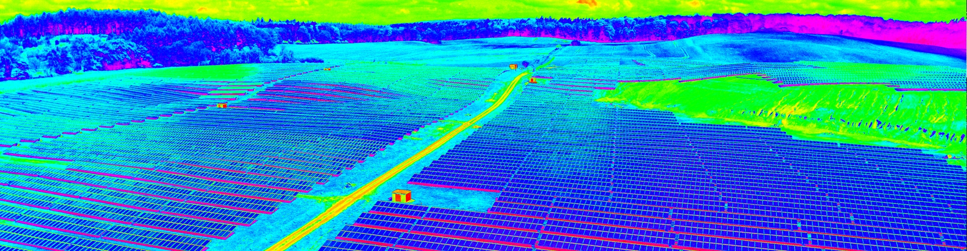
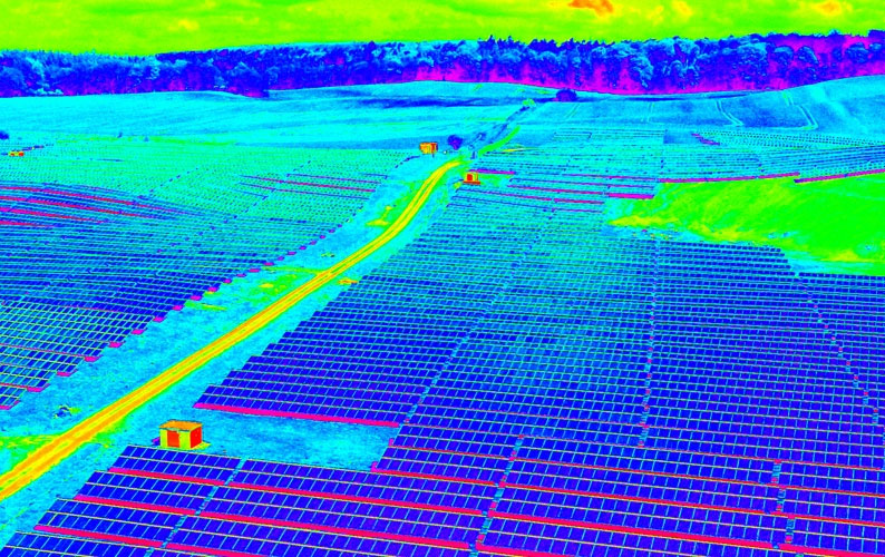
Thermal imaging is used to analyze and map temperature variations across large areas or complex structures. The technology has proven effective in a range of applications, including wildlife management, crop and livestock monitoring, and environmental assessment. It is also used to evaluate renewable energy sites such as wind farms, solar installations, and power plants, where accurate heat mapping helps detect inefficiencies and identify maintenance needs early.
Fair Lifts works with experienced aviation partners equipped with computer-assisted thermal imaging systems that process data in real time. This information is securely stored in cloud-based reporting platforms, allowing clients to review, compare, and track results as part of ongoing asset management or research programs.
Energy auditors and property managers also rely on aerial thermal imaging to pinpoint heat loss, insulation gaps, and other sources of energy waste in buildings and industrial facilities. These insights support cost savings, improved efficiency, and better long-term decision-making.
By coordinating access to advanced thermal imaging aircraft and technology, Fair Lifts helps clients manage their assets more effectively, safeguard investments, and maintain operational reliability across a wide range of industries.
Fair Lifts Projects in Focus
Fair Lifts coordinates a wide range of helicopter services designed to meet the unique challenges of complex aerial operations. Our project highlights showcase successful missions completed for commercial, industrial, environmental, and emergency response clients across North America. From precision placements in congested urban areas to critical deliveries in remote terrain, each project demonstrates the value of strategic planning and expert coordination.
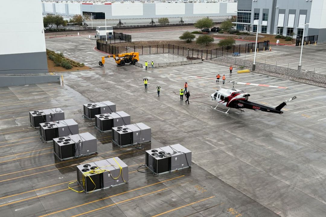
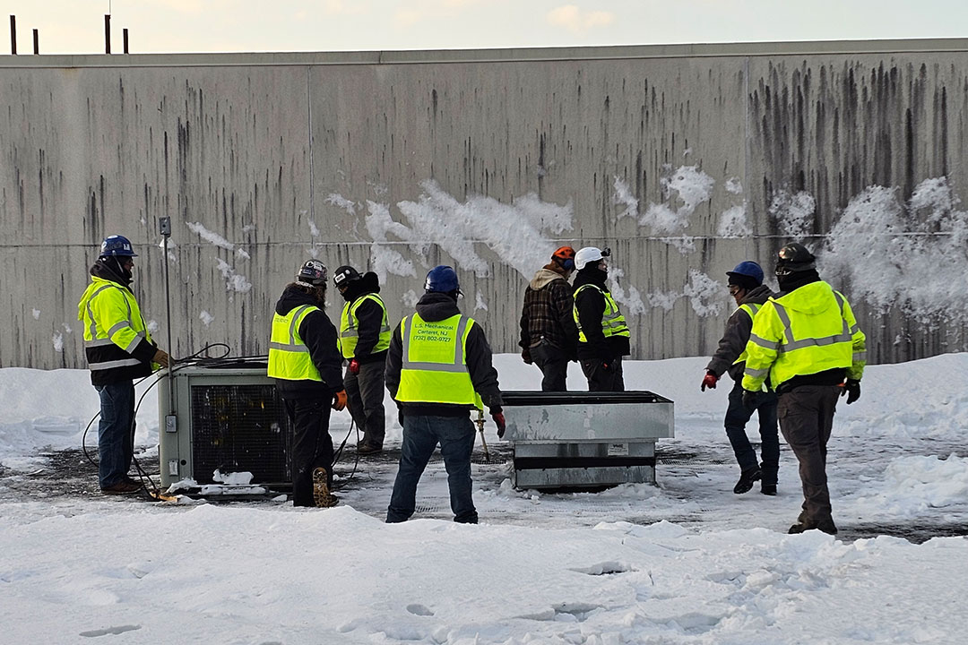
From Rooftop Removal to Replacement: Helicopter HVAC RTU Lift in Action
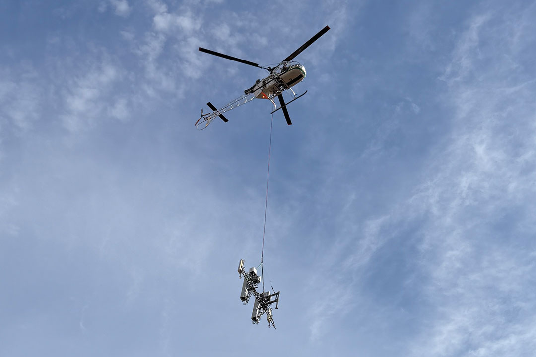
Next Edge Networks Selects Fair Lifts for Helicopter Telecom Tower Installation in Alabama
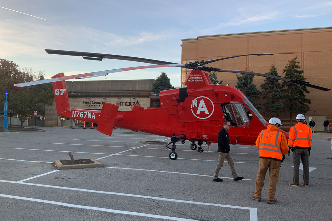
Helicopter HVAC Installation Lift Powers a Successful Electrical Upgrade at Macy’s
A Better Result for Better Building Systems: Helicopter HVAC Installation