Aerial surveys continue to play a critical role in industries such as agriculture, construction, forestry, and environmental monitoring. As the demand for precise and efficient data collection grows, advancements in helicopter technology have become a driving force in improving survey outcomes. For 2025, the following helicopters and innovations stand out as the best options for aerial survey missions.
Top Helicopter Models for Aerial Surveys in 2025
1. Airbus H145 D3

Airbus H145 D3
The Airbus H145 D3 is a standout choice for aerial surveys in 2025. With its five-blade main rotor, this model boasts a higher useful load, increased stability, and reduced vibration. The H145 D3’s compact design and exceptional maneuverability make it ideal for navigating challenging terrains while maintaining a smooth ride for survey equipment. Advanced avionics and compatibility with modern mapping tools ensure this helicopter meets the most demanding survey requirements.
Key Features:
- Five-blade main rotor for increased payload capacity.
- Advanced Helionix avionics suite for improved safety and navigation.
- Exceptional vibration control for smoother operations.
- Compact size for better access to confined areas.
2. Sikorsky S-76D

Sikorsky S-76D
Renowned for its reliability and performance, the Sikorsky S-76D is another excellent option. With a range of 441 nautical miles and a top speed of 155 knots, it excels in efficiency and endurance. Its spacious cabin can be customized to house sophisticated survey instruments, and its quiet operation ensures minimal disruption in sensitive environments, such as wildlife surveys.
Key Features:
- Pratt & Whitney PW210S engines for enhanced fuel efficiency.
- Quiet Zone technology for low-noise operations.
- Weather-tolerant design for diverse conditions.
- Spacious cabin for advanced survey equipment.
3. Rotor Technologies’ Airtruck

Rotor Technologies’ Airtruck
For unmanned operations, the Rotor Technologies’ Airtruck is leading the way. Designed specifically for heavy-lift multiuse applications, the Airtruck is an unmanned helicopter capable of carrying substantial payloads. Its versatility and adaptability to various survey scenarios make it a cost-effective and efficient solution, particularly for high-risk or remote environments.
Key Features:
- Unmanned design for high-risk environments.
- Heavy-lift capabilities for extensive payloads.
- Modular design for various survey configurations.
- Advanced autonomy for precise and efficient operations.
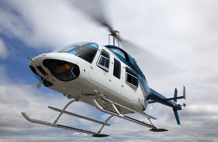
4. Bell 407GXi

Bell 407GXi
The Bell 407GXi is a versatile and reliable helicopter, making it a strong contender for aerial surveys in 2025. With its Garmin G1000H NXi integrated flight deck, the 407GXi provides enhanced situational awareness and precision. Its efficient fuel consumption, coupled with a spacious cabin, makes it an economical choice for long survey missions. The helicopter’s ability to operate in diverse climates and terrains ensures it meets the needs of various industries.
Key Features:
- Garmin G1000H NXi avionics for real-time data and navigation.
- Efficient Rolls-Royce 250-C47E/4 engine.
- High cruise speed for faster mission completion.
- Flexible interior for equipment installation.
5. Leonardo AW119Kx

Leonardo AW119Kx
The Leonardo AW119Kx is a single-engine helicopter that combines performance and advanced avionics, making it ideal for aerial surveys. Equipped with the Garmin G1000H integrated flight deck, it offers exceptional navigation and safety features. The AW119Kx is known for its high payload capacity and reliability, making it suitable for missions requiring heavy equipment. Its affordability and low maintenance costs make it a popular choice among survey operators.
Key Features:
- Garmin G1000H avionics for superior navigation.
- High payload capacity for demanding missions.
- Affordable operating costs for long-term use.
- Rugged design for challenging environments.
Innovations in Survey Equipment
Modern helicopters for aerial surveys are now integrated with state-of-the-art technology, including:
- High-Resolution Cameras: Capture detailed imagery for mapping and analysis.
- LiDAR Systems: Provide accurate 3D terrain modeling and vegetation mapping.
- Advanced GPS Systems: Ensure precise geolocation of survey data.
These tools, combined with helicopter-mounted stabilization systems, significantly enhance data quality and efficiency.
Key Considerations for Helicopter Selection
When choosing a helicopter for aerial surveys, it’s important to consider several factors:
- Performance: Assess range, speed, and altitude capabilities to ensure the helicopter aligns with your specific needs.
- Equipment Compatibility: Verify that the helicopter can accommodate the required survey instruments, including mounting options and power supply.
- Operational Costs: Evaluate the overall cost-effectiveness, including fuel efficiency and maintenance expenses.
- Safety Features: Prioritize models equipped with advanced avionics and robust safety systems to ensure secure operations.
The Future of Aerial Surveys
As technology advances, the integration of unmanned systems and automated data collection is becoming more prevalent. The combination of manned and unmanned aircraft, along with sophisticated equipment, is transforming aerial surveys, making them faster, safer, and more cost-effective.
For those seeking the best aerial survey solutions in 2025, the Airbus H145 D3, Sikorsky S-76D, Rotor Technologies’ Airtruck, Bell 407GXi, and Leonardo AW119Kx offer unmatched performance and innovation. Whether you require precise mapping, environmental assessments, or infrastructure inspections, these helicopters deliver cutting-edge capabilities to meet the evolving demands of aerial surveying.