
Aerial surveys continue to play a critical role in industries such as agriculture, construction, forestry, and environmental monitoring. As the demand for precise and efficient data collection grows, advancements in helicopter technology remain a driving force in improving survey outcomes. For 2026, the following helicopters and innovations stand out as the best options for aerial survey missions.
Table of Contents
- Top Helicopter Models for Aerial Surveys in 2026
- Innovations in Survey Equipment
- Key Considerations for Helicopter Selection
- The Future of Aerial Surveys
Top Helicopter Models for Aerial Surveys in 2026
1. Airbus H145 D3

Airbus H145 D3 | Photo: airbus.com
The Airbus H145 D3 remains a standout choice for aerial surveys in 2026. With its five-blade main rotor, this model delivers a higher useful load, increased stability, and reduced vibration compared to its predecessors. The H145 D3’s compact design and exceptional maneuverability make it ideal for navigating challenging terrains while maintaining a smooth ride for survey equipment. The H145 has now accumulated more than 8.5 million flight hours across its family, a testament to its reliability in demanding operational environments. Advanced avionics, enhanced connectivity, and compatibility with modern mapping tools ensure this helicopter continues to meet the most demanding survey requirements in 2026.
Key Features:
- Five-blade main rotor for a 150 kg increase in useful load over prior variants.
- Helionix digital avionics suite with a high-performance four-axis autopilot for improved safety and reduced pilot workload.
- Particularly low acoustic footprint, the quietest helicopter in its class.
- Compact “D-value” footprint for operations in confined areas.
- Wireless airborne communication server (wACS) for secure ground-to-air data exchange.
- Certified to operate at altitudes up to 20,000 ft, the only rotorcraft in its range to achieve this.
2. Sikorsky S-76D

Sikorsky S-76D | Photo: lockheedmartin.com
Renowned for its reliability and performance, the Sikorsky S-76D remains an excellent option for aerial survey work in 2026. With a range of 441 nautical miles and a top speed of 155 knots, it excels in efficiency and endurance. Its spacious cabin can be customized to house sophisticated survey instruments, and its quiet operation ensures minimal disruption in sensitive environments, such as wildlife surveys.
Key Features:
- Pratt & Whitney PW210S engines for enhanced fuel efficiency.
- Quiet Zone technology for low-noise operations in sensitive survey environments.
- Weather-tolerant design for diverse operating conditions.
- Spacious, configurable cabin for advanced survey equipment installations.
3. Rotor Technologies’ Airtruck (R44 Platform)

Rotor Technologies’ Airtruck | Photo: roto.ai
For unmanned operations, the Rotor Technologies’ Airtruck has continued to grow in prominence heading into 2026. Deliveries of 2025 model year aircraft to customers in the United States and Brazil are now underway, with the platform formally integrated into Robinson Helicopter Company’s newly established Robinson Unmanned business unit as of March 2026. Built on the Robinson R44 airframe and powered by the RPX autonomy suite, the Airtruck carries over 1,000 lbs of payload and represents the world’s largest commercially available civilian drone. Its versatility makes it a cost-effective and efficient solution for high-risk or remote survey environments where removing the pilot from harm’s way is a priority.
Key Features:
- Unmanned design powered by Rotor Technologies’ RPX autonomy suite.
- Over 1,000 lb payload capacity for extensive survey equipment.
- Maximum takeoff weight of 2,500 lbs, the largest of any commercially available civilian drone.
- Four concurrent communications links including line-of-sight radios, 4G/LTE, and Starlink.
- Five onboard cameras plus terrain LiDAR for full situational awareness.
- Lycoming 6-cylinder aviation engine for long flight times without electric charging infrastructure.
- Road-transportable without disassembly, with under 15-minute field setup.
4. Bell 407GXi

Bell 407GXi | Photo: bellflight.com
The Bell 407GXi continues to be a versatile and reliable helicopter and a strong contender for aerial surveys in 2026. With its Garmin G1000H NXi integrated flight deck, the 407GXi provides enhanced situational awareness and precision. Its efficient fuel consumption, combined with a spacious cabin, makes it an economical choice for long survey missions. The helicopter’s proven ability to operate across diverse climates and terrains ensures it meets the needs of operators across multiple industries.
Key Features:
- Garmin G1000H NXi avionics for real-time data and precision navigation.
- Efficient Rolls-Royce 250-C47E/4 engine for extended range.
- High cruise speed for faster mission completion across large survey areas.
- Flexible interior for custom equipment installation.
5. Leonardo AW119Kx

Leonardo AW119Kx | Photo: leonardo.com
The Leonardo AW119Kx is a single-engine helicopter that combines strong performance with advanced avionics, making it a practical and cost-efficient choice for aerial surveys in 2026. Equipped with the Garmin G1000H integrated flight deck, it offers exceptional navigation and safety features. The AW119Kx is well regarded for its high payload capacity and operational reliability, making it suitable for missions requiring heavy sensor equipment. Its lower operating and maintenance costs continue to make it a popular choice among survey operators working to manage long-term budgets.
Key Features:
- Garmin G1000H avionics for superior navigation and situational awareness.
- High payload capacity for demanding, equipment-heavy missions.
- Affordable operating costs well suited to long-term commercial use.
- Rugged design for challenging and remote environments.
Innovations in Survey Equipment
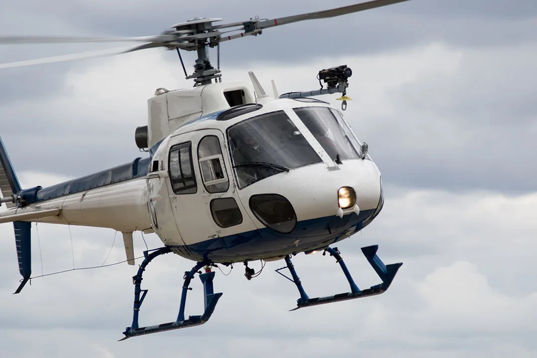
Aerial Survey Helicopter outfitted with high resolution camera.
Modern helicopters for aerial surveys are now integrated with state-of-the-art technology, including:
- High-Resolution Cameras: Capture detailed imagery for mapping and analysis across large areas.
- LiDAR Systems: Provide accurate 3D terrain modeling, vegetation mapping, and point cloud data for engineering and environmental applications.
- Advanced GPS and GNSS/IMU Integration: Ensure precise geolocation of survey data with centimeter-level accuracy.
- AI-Assisted Data Processing: Onboard and post-flight AI tools are increasingly automating data interpretation and reducing turnaround time from flight to deliverable.
These tools, combined with helicopter-mounted stabilization systems, significantly enhance data quality and operational efficiency.
The Future of Aerial Surveys

An Airbus H145 Helicopter | Photo: airbus.com
As technology continues to advance through 2026, the integration of unmanned systems and AI-assisted data collection is becoming standard practice across the industry. The teaming of manned helicopters with autonomous platforms is a growing operational model, with manufacturers like Airbus actively developing crewed and uncrewed aircraft that work in tandem. This combined approach is transforming aerial surveys, making them faster, safer, and more cost-effective than ever before.
For those seeking the best aerial survey solutions in 2026, the Airbus H145 D3, Sikorsky S-76D, Rotor Technologies’ Airtruck, Bell 407GXi, and Leonardo AW119Kx offer proven performance and cutting-edge innovation. Whether you require precise mapping, environmental assessments, or infrastructure inspections, these aircraft deliver the capabilities needed to meet the evolving demands of modern aerial surveying.