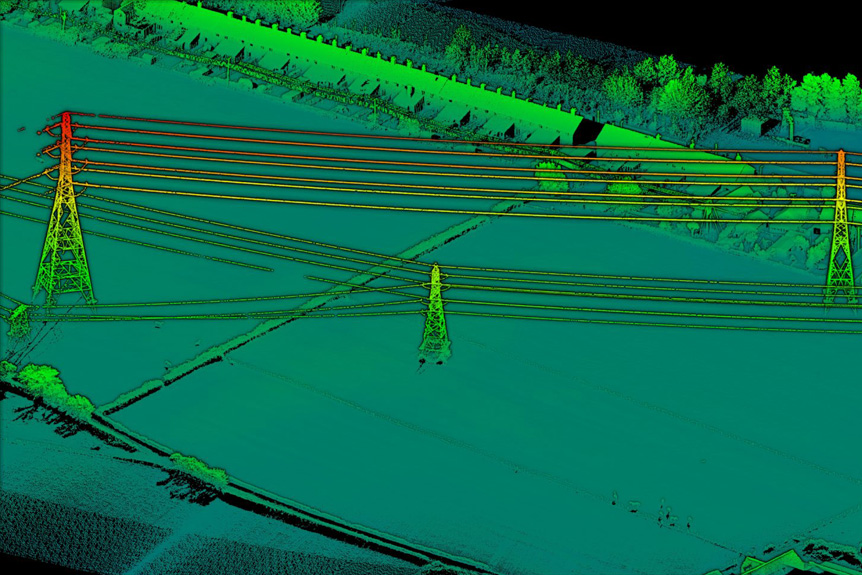
How Does a Helicopter LIDAR System Work? September 12, 2018 Aerial Surveys - Helicopter Services A helicopter LIDAR system uses laser pulses to map terrain, measuring distances by timing the reflection of light. Aerial ApplicationsAerial SurveyingHelicopter ServicesLIDARLIDAR SystemTechnology