The WingtraOne Gen II drone represents the cutting edge of aerial survey technology, combining LIDAR and multispectral imaging to deliver unmatched data precision. As aerial survey drones continue to revolutionize remote sensing, this advanced platform stands out for its exceptional efficiency and comprehensive data collection capabilities.
The Evolution of Aerial Surveying
Aerial surveying traces its roots to 1850s France, where photographer Gaspard-Félix Tournachon (Nadar) captured the first aerial images from hot air balloons. The field progressed significantly when James Wallace Black took successful aerial photographs over Boston in 1860. By 1882, E.D. Archibald pioneered unmanned aerial photography using kites, while Alfred Maul later introduced rocket-mounted cameras in the early 20th century. World War I expanded capabilities through fixed-wing aircraft reconnaissance, and the Vietnam War era saw the first widespread use of reconnaissance UAVs, setting the stage for modern aerial survey technologies.
WingtraOne Gen II: A Technological Leap Forward
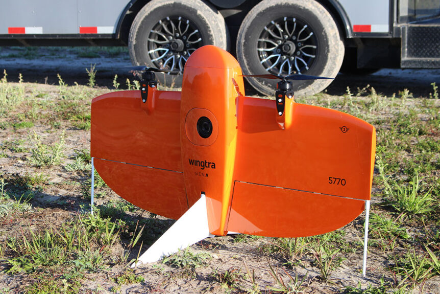
Fair Lifts’ WingtraOne Gen II Aerial Survey Drone
The WingtraOne Gen II redefines aerial survey standards with its unique VTOL (Vertical Take-Off and Landing) design, merging rotary-wing versatility with fixed-wing efficiency. Its impressive 59-minute flight time and 61 MP camera enable extensive high-resolution data collection. The integrated PPK GNSS receiver achieves remarkable 1 cm horizontal accuracy without ground control points, significantly streamlining survey operations.
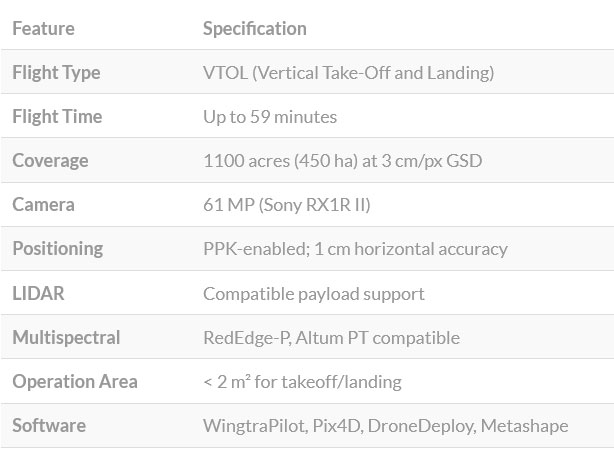
Performance by the Numbers
| Feature | Specification |
|---|---|
| Flight Type | VTOL (Vertical Take-Off and Landing) |
| Flight Time | Up to 59 minutes |
| Coverage | 1100 acres (450 ha) at 3 cm/px GSD |
| Camera | 61 MP (Sony RX1R II) |
| Positioning | PPK-enabled; 1 cm horizontal accuracy |
| LIDAR | Compatible payload support |
| Multispectral | RedEdge-P, Altum PT compatible |
| Operation Area | < 2 m² for takeoff/landing |
| Software | WingtraPilot, Pix4D, DroneDeploy, Metashape |
LIDAR: Precision 3D Mapping
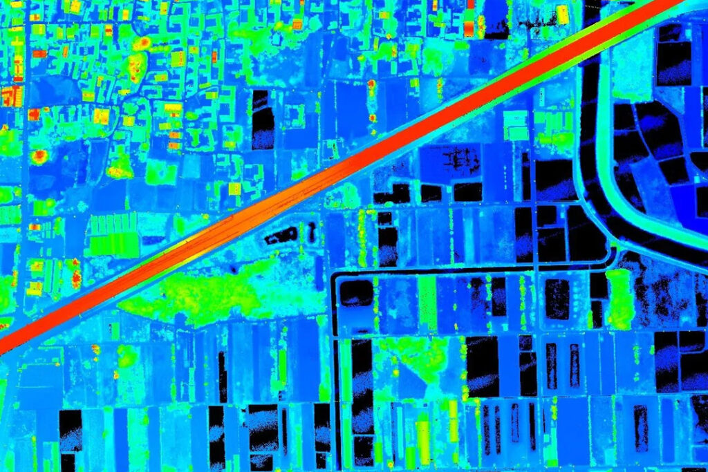
Wingtra LIDAR | Photo: wingtra.com
LIDAR technology revolutionizes terrain mapping by using pulsed lasers to create precise three-dimensional surface models. This system, comprising a laser, scanner, and specialized GPS, excels in rapid large-area data collection. Its applications range from creating detailed digital elevation models to supporting emergency response operations with accurate topographic data.
Multispectral Imaging: Beyond Visible Light
Multispectral imaging captures data across multiple electromagnetic spectrum bands (typically 4-12), revealing information invisible to standard cameras. By analyzing surface reflectance patterns, this technology enables advanced vegetation assessment, land-use classification, and environmental monitoring with unparalleled detail.
Integrated Survey Solution
The WingtraOne Gen II uniquely combines LIDAR and multispectral imaging to deliver comprehensive survey data. This dual-capability supports applications like precision agriculture, where simultaneous terrain and vegetation analysis is crucial, and environmental monitoring, providing both structural and compositional landscape insights.
Superior Performance Features
- Operational Efficiency: VTOL design enables confined-area operations with fixed-wing range
- Survey Accuracy: Centimeter-level PPK GNSS precision minimizes ground control needs
- Sensor Flexibility: Supports cameras, LIDAR, and multispectral payloads for diverse applications
- User Experience: Intuitive flight planning via rugged tablet simplifies operations
Industry Applications
- Agriculture: Crop health monitoring and soil analysis through multispectral data
- Environmental Science: Ecosystem change tracking using combined topographic/spectral data
- Urban Development: High-accuracy mapping for infrastructure planning
- Resource Industries: Site surveying for volume calculations and safety assessments
Transforming Data Collection from Above

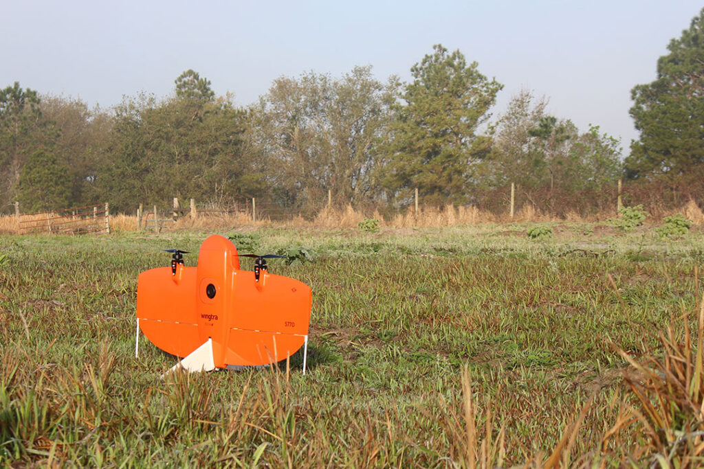
Wingtra One Drones | Photo: wingtra.com
The WingtraOne Gen II drone represents a pinnacle in aerial survey technology, seamlessly integrating LIDAR and multispectral imaging to deliver comprehensive, precise data across multiple industries. This advanced platform continues to push the boundaries of what’s possible in remote sensing and geospatial analysis.
Partner with Fair Lifts for Professional Drone Surveying Services
Ready to take your surveying operations to new heights? Fair Lifts’ Drone Services offers advanced aerial survey solutions using the powerful WingtraOne Gen II drone, equipped with cutting-edge LIDAR and multispectral imaging capabilities. Whether you’re mapping land, monitoring crops, or managing large infrastructure projects, our team delivers the precision and efficiency your project demands.
Contact us today at 1-800-318-8940 to schedule your drone survey or learn more about how Fair Lifts can support your aerial data collection needs.