The Wingtra RAY survey drone redefines aerial surveying by delivering long flight times, expansive coverage, high precision, and an integrated workflow that takes you from mission planning to GIS or CAD deliverables quickly .
The Integrated System That Redefines Surveying
Wingtra RAY is built as a comprehensive system that links planning, data capture, processing, and sharing. It features tablet based mission planning, vertical takeoff and landing thanks to its tailsitter VTOL design, and exports deliverables in standard CAD and GIS formats via WingtraCLOUD.
Achieve Unprecedented Coverage Speed
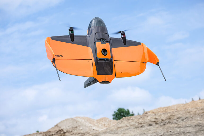
The Wingtra RAY shortly after take-off. | Photo: wingtra.com
Fast coverage is a standout feature. The manufacturer states up to 59 minutes of flight time and up to 1,360 acres of area covered in a single mission when using the MAP61 payload. For time sensitive jobs the platform is marketed to map about 245 acres in around 10 minutes, enabling smaller crews and faster completion.
Precision Data and the Power to Adapt
Accuracy is critical for survey applications. Wingtra RAY is documented to achieve 3 cm absolute accuracy (RMS x, y, z) when used with the recommended PPK workflow and calibration points. This precision supports large site mapping, volume measurement, and engineering work.
The drone supports a modular payload system with hot swap capabilities. The MAP61 61 MP camera enables fast, high resolution 2D and 3D capture across large sites; other payloads cover specialized inspection, nadir photogrammetry, multispectral, and LiDAR workflows.
Operational compliance and site ready reliability
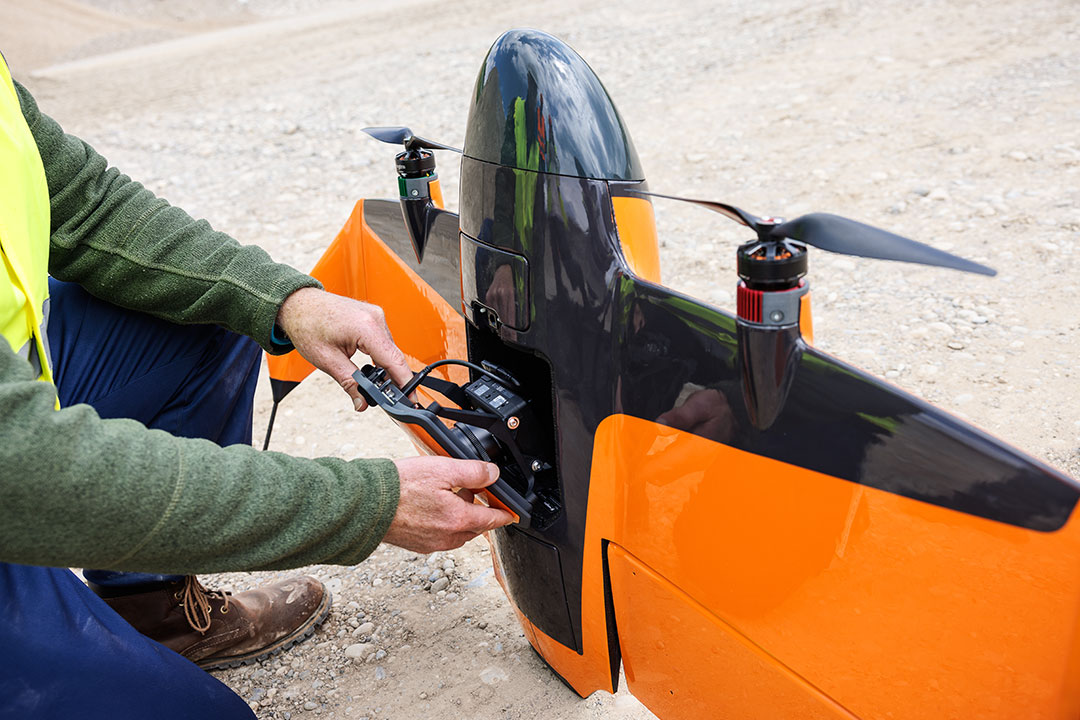
Accessing the onboard camera equipment. | Photo: wingtra.com
Aerial surveys frequently operate near roads, job sites, or populated areas. Wingtra RAY supports an optional parachute add on that aligns with Category 3 operations over people standards in the U.S., reducing certification overhead on many jobs. The design also supports obstacle avoidance, dual telemetry links (radio and LTE) for extended range, and wind resilience around 12 m/s sustained and up to 18 m/s gusts in flight conditions.
Seamless Data Flow from Field to Deliverable
The Wingtra RAY survey drone integrates planning, capture, and processing into one connected ecosystem. Missions are setup via tablet, imagery flows into WingtraCLOUD, and deliverables export in common formats for CAD/GIS review. This end to end path reduces delays and keeps field teams aligned with office workflows.
Built for Demanding Survey Projects
- Wide area coverage in fewer flights. Large area capture per sortie means fewer battery swaps and ground resets.
- High accuracy. Precision down to 3 cm supports engineering deliverables with confidence.
- One drone for many tasks. Modular payloads let the same airframe adapt from stockpile volume to runway inspection to vegetation mapping.
- Safer operations near people. The Category 3 ready parachute system supports safer work in built environments.
- Streamlined data pipelines. Cloud processing and deliverables in CAD/GIS formats accelerate project turnaround.
Applications across industries
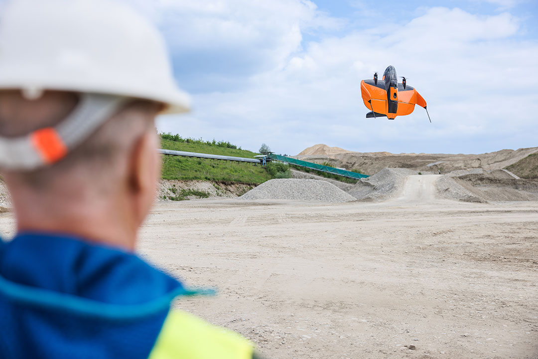
A Wingtra Ray aerial survey drone sits at rest at a job site. | Photo: wingtra.com
In construction and infrastructure, the Wingtra RAY survey drone captures ortho, DSM and point cloud data that keep engineers and project managers up to date with progress, as built comparisons and safer site documentation.
For mining and earthworks the large area capability and hot swappable sensor system make it easier to perform volumetric analysis, pit mapping and stockpile tracking without investing in multiple platforms.
Environmental and agriculture teams benefit from frequent aerial coverage at scale. With the MAP61 payload or multispectral/LiDAR options the Wingtra RAY survey drone enables consistent monitoring of vegetation, wetlands and terrain changes.
Transforming Data into Actionable Insight
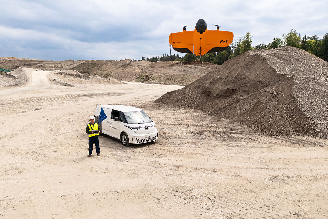
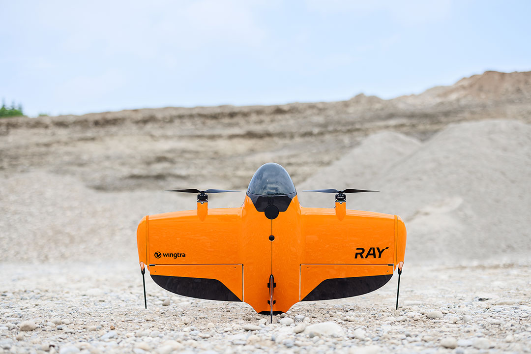
A Wingtra RAY in-flight. | Photo: wingtra.com
The Wingtra RAY survey drone delivers the speed, precision, adaptability and connected workflow that modern aerial surveying demands. With large area coverage, survey grade accuracy, modular sensors, Category 3 ready compliance and an integrated processing ecosystem the platform is designed for real world survey operations.
Partner with Fair Lifts for your aerial surveys to raise your capabilities, reduce field time, improve deliverables, and simplify workflows with drones like the compelling Wingtra RAY drone.