Navigating the world of UAVs and aerial robotics can be overwhelming. This comprehensive drone terminology glossary serves as a go-to reference for clients, professionals, and newcomers alike. Whether coordinating aerial surveys, agricultural drone spraying, or inspection services, this resource helps clarify the language of modern drone operations.
Table of Contents
- 1. General Drone Terms
- 2. Flight & Navigation Terms
- 3. Regulatory & Certification Terms
- 4. Aerial Data Collection Terms
- 5. Components & Hardware
- 6. Payload & Mission-Specific Terms
- 7. Operational Terminology
- 8. Drone Safety Procedures
- 9. Emerging Drone Technologies
General Drone Terms
- Drone: A common term for UAV, typically used in commercial and recreational contexts.
- Fixed-Wing Drone: A UAV designed like an airplane, ideal for long-range and high-endurance missions.
- Multirotor: A drone with multiple rotors, such as quadcopters or octocopters, offering vertical lift and hover capabilities.
- Nano Drone: Tiny UAVs typically used indoors or in tight environments.
- UAS (Unmanned Aircraft System): Includes the UAV, ground control system, data link, and support equipment.
- UAV (Unmanned Aerial Vehicle): An aircraft without a human pilot onboard, remotely operated or autonomous.
Flight & Navigation Terms
- Acro (Acrobatic Mode): A manual flight mode allowing freestyle tricks and precise maneuvers.
- First Person View (FPV): Live video transmission from the drone’s perspective, often used with goggles.
- Geographic Information System (GIS): Software for managing spatial and mapping data.
- GPS (Global Positioning System): Satellite-based system enabling navigation and positioning for drones.
- IMU (Inertial Measurement Unit): Detects motion, orientation, and gravitational forces to maintain flight stability.
- Line of Sight (LOS): Direct visual contact between the pilot and the UAV during operation.
- Return to Home (RTH): Automatically returns the drone to its launch point, triggered by signal loss or low battery.
- Throttle: Control for adjusting motor power and managing altitude.
- Thrust: Vertical force generated by propellers to lift the UAV.
Regulatory & Certification Terms
- BVLOS (Beyond Visual Line of Sight): Operations conducted without the UAV being visible to the operator, requiring special waivers.
- COA (Certificate of Authorization): Official FAA approval for public entities to conduct UAV operations.
- FAA (Federal Aviation Administration): The U.S. regulatory agency overseeing drone flight and airspace safety.
- Part 107: FAA rule that governs commercial UAV operations, including licensing requirements for drone pilots.
Aerial Data Collection Terms
- LiDAR (Light Detection and Ranging): Remote sensing method using laser pulses to create detailed 3D terrain models.
- NDVI (Normalized Difference Vegetation Index): Measures plant health based on light absorption from multispectral images.
- Photogrammetry: Process of converting aerial photographs into maps, models, and spatial data.
- RTK (Real-Time Kinematic): GPS enhancement technology for high-precision positioning, essential for survey-grade accuracy.
Components & Hardware
- ESC (Electronic Speed Controller): Device that regulates and varies the motor speeds in multirotor drones.
- Flight Controller: The drone’s central processor that manages orientation, stabilization, and navigation.
- Gimbal: A stabilizing mount for UAV cameras that allows for smooth, shake-free imaging.
- Gyroscope: Measures rotational movement to maintain drone stability.
- Propeller: Rotating blade that generates thrust and lift, with variations depending on drone size and purpose.
Payload & Mission-Specific Terms
- Mapping Drone: UAV configured for collecting geographic data and producing orthomosaic maps or digital elevation models.
- Payload: The onboard equipment carried by a UAV, such as cameras, LiDAR sensors, or agricultural sprayers.
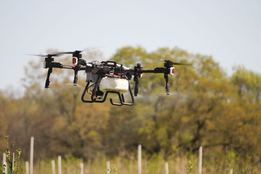
- Spray Drone: A UAV equipped to apply liquids—commonly used in precision agriculture by Fair Lifts Unmanned Services.
- Thermal Imaging: Captures heat signatures, useful for inspections, search and rescue, and energy audits.
Operational Terminology
- Failsafe: Built-in protocols that activate protective measures (e.g., auto-landing or RTH) in emergencies.
- Geofencing: Virtual perimeter that restricts drone movement within or beyond certain boundaries.
- Ground Control Station (GCS): Platform for monitoring and controlling UAV flight and telemetry.
- Telemetry: Real-time data transmission between the UAV and ground control, including altitude, speed, and location.
- Waypoint: Predefined GPS location used for autonomous UAV navigation.
- Waypoint Navigation: Predefined flight path executed autonomously by the drone’s software.
Drone Safety Procedures
- Emergency Protocols: Procedures for handling GPS loss, battery failure, or loss of signal to minimize risk to people and property.
- No-Fly Zones: Restricted airspace where drone operations are prohibited, often near airports or critical infrastructure.
- Pre-Flight Checklist: Routine inspection of batteries, propellers, GPS lock, firmware, and weather conditions.
- Visual Observer (VO): An additional crew member who helps maintain situational awareness during flight.
Emerging Drone Technologies
- 5G Drone Connectivity: Enhances real-time communication and remote piloting capabilities for long-range missions.
- AI-Powered Autonomy: Use of machine learning algorithms for obstacle avoidance, route optimization, and real-time data processing.
- Drone-in-a-Box: Autonomous docking stations enabling fully automated takeoff, landing, and recharging—ideal for industrial site monitoring.
- Swarm Drones: Multiple UAVs operating in coordination for tasks like search and rescue or military surveillance.
Fair Lifts Unmanned Services
At Fair Lifts, we use advanced UAV technology across industries including agriculture, infrastructure, and environmental monitoring. Our certified operators and data analysts are here to assist with precision aerial operations of any scale.
Need a customized drone solution? Call Fair Lifts Unmanned Services at 1-800-318-8940 today.