Authorities impose flight restrictions over Nashville bombing site to ensure safety and facilitate investigation efforts.

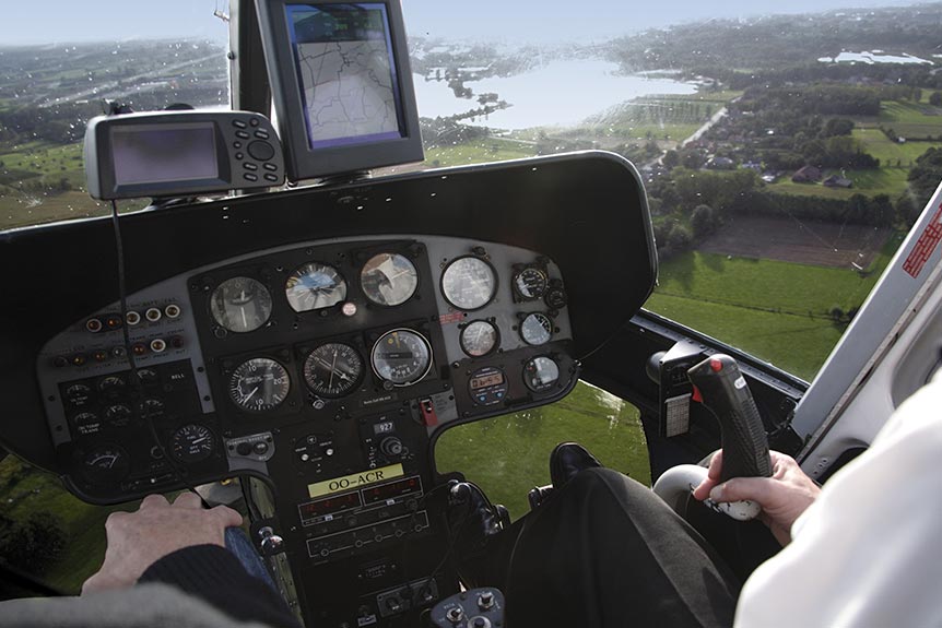
Using helicopters for aerial surveys is a popular and efficient way to collect data and information for a variety of industries and projects. The articles in this category provide readers with an in-depth look at the many advantages of using helicopters for aerial surveys, including their ability to cover large areas quickly and efficiently, and their ability to provide a high level of detail and accuracy in the collected data. The articles discuss the different types of sensors and equipment that are used in aerial surveys and how they are mounted on helicopters. They also explore the skills and qualifications required of helicopter pilots and surveyors to safely and effectively conduct aerial surveys. Readers can expect to gain a thorough understanding of the process involved in conducting aerial surveys using helicopters, as well as the benefits and limitations of this technique in various fields, from environmental monitoring and mapping to land surveying and infrastructure planning.
Authorities impose flight restrictions over Nashville bombing site to ensure safety and facilitate investigation efforts.
“Elevate your surveys: Helicopters offer unparalleled views, precision, and efficiency in aerial assessments.”
Soaring low over the Mississippi Alluvial Plain, the view below unfolds a tapestry of rivers, forests, and fertile lands.

Drones buzz over New Orleans, capturing vital data from miles of twisting pipelines, ensuring safety and efficiency.

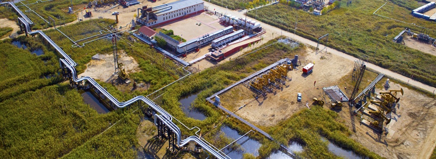
“Exploring Houston`s pipeline landscape: a vital survey ensuring safety & efficiency in Texas` energy corridor.”
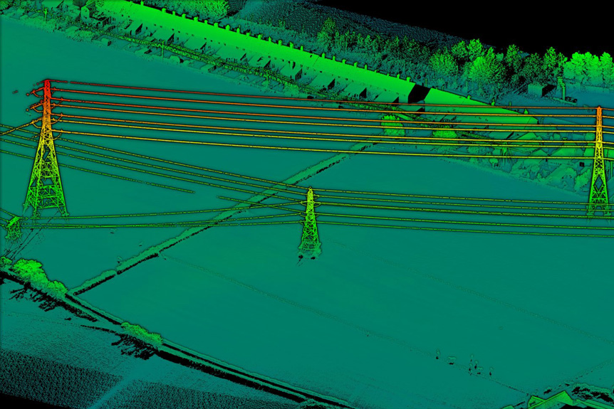
A helicopter LIDAR system uses laser pulses to map terrain, measuring distances by timing the reflection of light.

Helicopter inspections boost pipeline surveys in Alaska, offering a bird`s-eye view to enhance efficiency and safety.