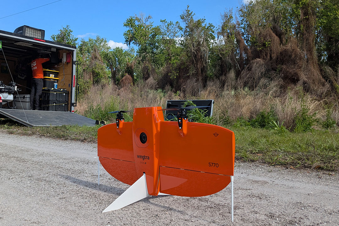
The WingtraOne Gen II drone represents the cutting edge of aerial survey technology, combining LIDAR and multispectral imaging to deliver unmatched data precision. As aerial survey drones continue to revolutionize remote sensing, this advanced platform stands out for its exceptional efficiency and comprehensive data collection capabilities. The Evolution of Aerial Surveying Aerial surveying traces its roots to 1850s France, where …
Showing all pages tagged with wingtraone gen ii
Aerial Survey Drone Project in Indian Hammock, Florida: Evaluating the Impact of Lygodium Control Efforts
On February 26, 2025, Fair Lifts Drone Services completed an aerial survey drone project for the Indian Hammock Hunt & Riding Club, a private recreational community in Okeechobee County, Florida. The goal was to capture high-resolution imagery and evaluate the effectiveness of an October 2024 wet drone herbicide spray operation targeting invasive lygodium vines across 70 acres. Indian Hammock Hunt …

