In a landmark collaboration reshaping the future of agricultural technology, XAG and PIX4D have joined forces to bring cutting-edge mapping and spraying capabilities to farms worldwide. This strategic partnership merges XAG’s globally recognized agricultural drones with PIX4D’s industry-leading photogrammetry and mapping software, delivering unprecedented precision and efficiency to growers.
At Fair Lifts, we proudly utilize XAG drones for our agricultural drone services, and this integration directly enhances our ability to serve farmers with data-backed, precision-driven crop solutions.
What is PIX4D and Why It Matters

Area rates assigned for variable rate nitrogen application (right) based on NDVI index (left) in PIX4Dfields | Photo: pix4d.com
PIX4D is a Swiss-based company that develops photogrammetry software used to convert drone imagery into actionable 2D maps and 3D models. Their software is especially popular in agriculture, construction, mining, and surveying for generating detailed orthomosaics, NDVI maps, and topographic models. For precision agriculture, PIX4D provides Fair Lifts with accurate insights on crop health, soil variability, and vegetation patterns. Their flagship product, PIX4Dfields, processes multispectral and RGB data into precise application maps—now seamlessly compatible with XAG drones.
XAG: A Leader in Agricultural Drone Innovation
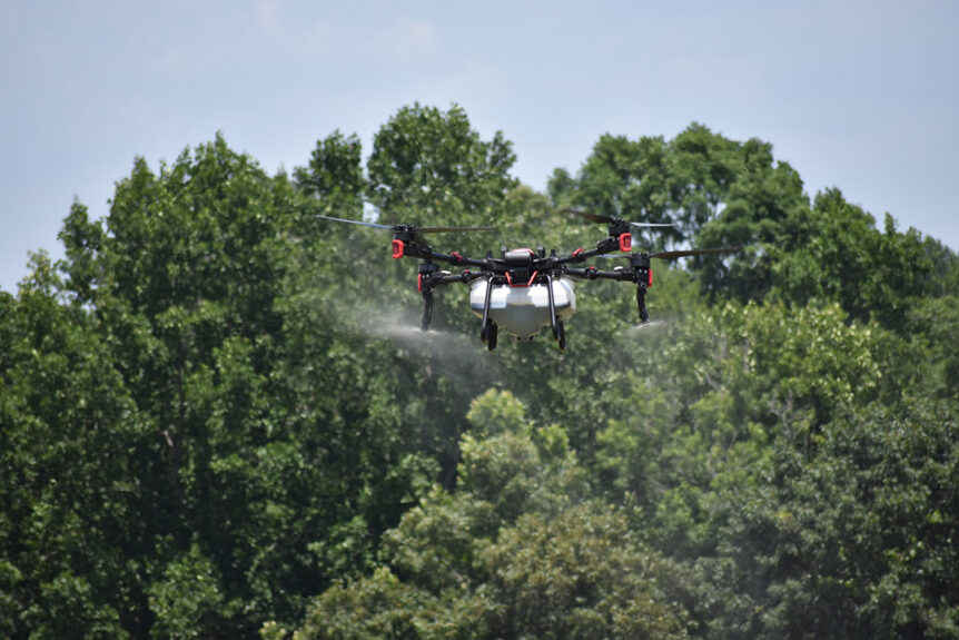
XAG is one of the world’s foremost agricultural drone manufacturers, with a product line that includes the XAG P100 Pro and P150 spraying drones. Known for their autonomous flight capabilities, large payload capacity, and ultra-low-altitude spraying precision, XAG drones are engineered specifically for modern farm operations. Fair Lifts uses these drones to deliver efficient, safe, and cost-effective crop spraying, seeding, fertilization, and greenhouse coating services across the Southeastern United States.
About the XAG and PIX4D Partnership
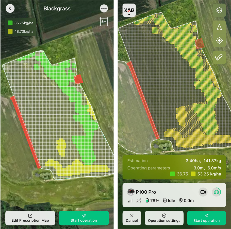
Based on the prescription maps created in PIX4Dfields, the XAG drone can adjust its flight path and skip areas that do not require application. | Photo: xa.com
According to the official announcement by XAG, the partnership was formalized to ensure tighter integration between XAG drone hardware and PIX4D’s advanced mapping tools. Operators can now import prescription maps directly from PIX4Dfields into XAG’s flight control app with a few simple clicks. This streamlines the workflow from drone imagery capture to actionable spraying missions, reducing time spent on manual uploads, formatting, or data conversions.
Key goals of the partnership include:
- Creating a seamless digital farming workflow from field mapping to autonomous drone operation
- Improving accuracy of variable-rate applications through easy import of prescription maps
- Empowering farmers and service providers to respond faster to crop variability and pest outbreaks
How It Works: From Data to Action
The integration of PIX4Dfields with XAG drones enables a streamlined process:
- Image Capture: A drone flight captures multispectral or RGB imagery of the farmland.
- Map Processing: PIX4Dfields processes the imagery into NDVI maps or prescription files indicating where treatment is needed.
- Data Transfer: The generated prescription map is uploaded directly into the XAG agricultural app.
- Mission Execution: XAG drones autonomously follow the uploaded map to apply herbicides, fertilizers, or coatings with pinpoint precision.
How Fair Lifts Leverages This Technology
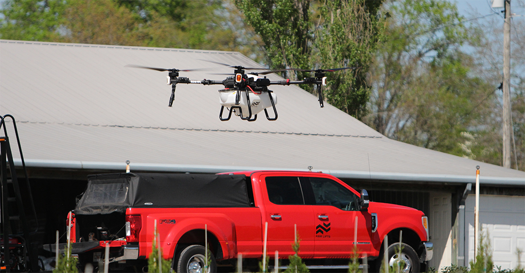
Fair Lifts’ XAG P100 Pro HP and the Fair Lifts UAS Team Vehicle
Fair Lifts’ agricultural drone operations benefit directly from the XAG and PIX4D integration. With field-specific application maps generated using PIX4Dfields, we ensure:
- Reduced Chemical Waste: Only the necessary amount of product is applied, where it’s needed most.
- Faster Turnaround: Clients receive same-day mapping and application services in many cases.
- Higher Accuracy: Precision is improved thanks to real-time kinematics (RTK) GPS and consistent NDVI analysis.
- Environmental Stewardship: Better targeting means reduced runoff and drift, helping protect local ecosystems.
Why This Partnership Is a Big Deal for Precision Agriculture
The collaboration between XAG and PIX4D highlights a key advancement in agri-tech: seamless integration between drone systems and data analytics. For drone service providers like Fair Lifts, delivering rapid, data-driven insights is critical to optimizing agricultural efficiency. By accelerating the process from aerial survey to field action, this partnership empowers timely interventions—enhancing productivity and maximizing yields for the growers we support.
Moreover, the combined solution is scalable and user-friendly. Whether you’re managing a 10-acre specialty crop or a 2,000-acre row crop operation, the process is adaptable to different farm sizes and crops.
Looking Ahead: Future Possibilities
While the current focus is on improving spraying and mapping workflows, the collaboration between XAG and PIX4D may soon expand into AI-driven agronomy recommendations, soil moisture monitoring, or multi-temporal analysis for season-over-season improvements. With increasing interest in sustainable farming and regulatory support for precision tools, this partnership is poised to drive the next wave of smart agriculture.
Partnering for Progress in Precision Agriculture
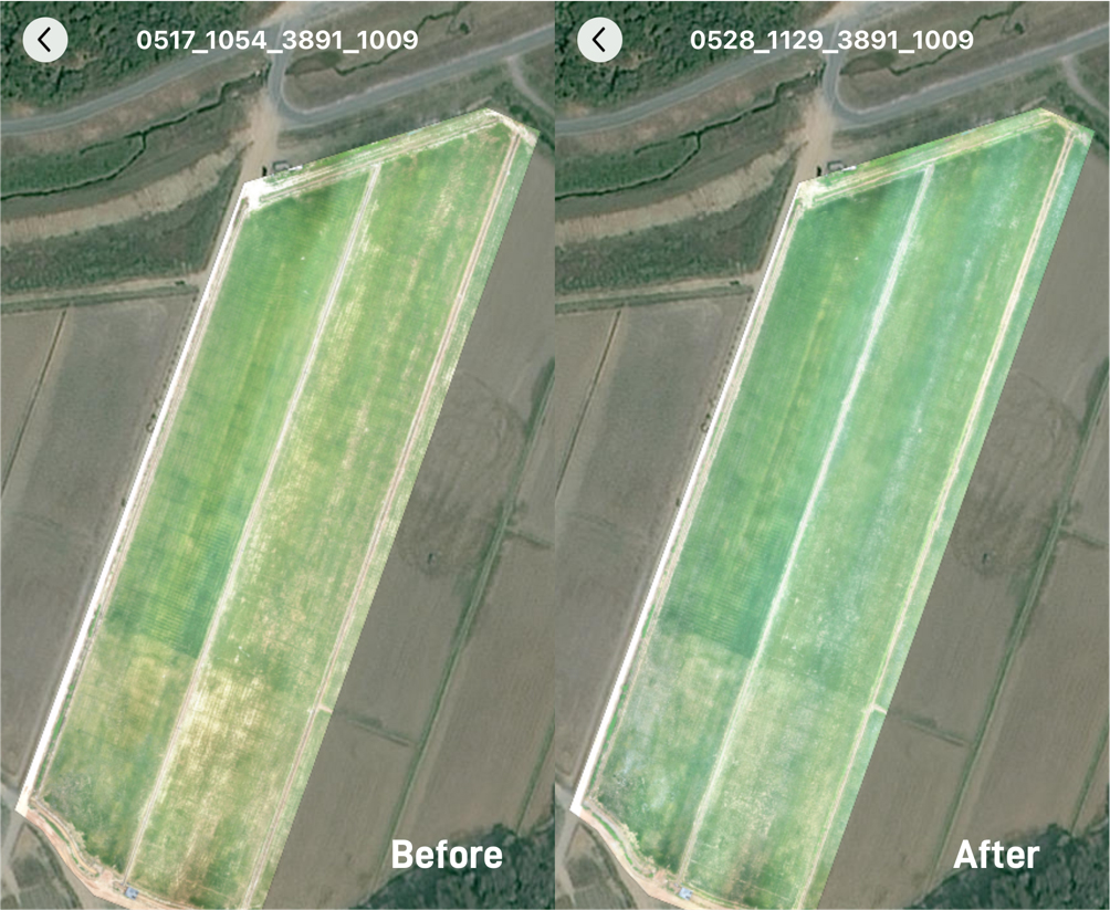
HD field maps show that rice growth in SuperX Farm was more uniform using XAG prescription maps for fertilizer spreading | Photo: xa.com
The integration of XAG drones with PIX4D’s powerful mapping engine represents a significant advancement for Fair Lifts’ agricultural drone services. This seamless technology allows our team to offer faster, more accurate, and data-driven solutions to our clients. By streamlining the process from mapping to application, we enhance crop performance, reduce chemical and fertilizer waste, and contribute to a more sustainable and efficient farming operation.
For growers interested in learning more about how we can help with agricultural drone services using XAG and PIX4D solutions, contact our UAV team today or call 1-800-318-8940.