As Perry, Florida, along with neighboring areas like Steinhatchee and Cedar Key, grapple with the aftermath of Hurricane Idalia, the importance of rapid and precise aerial damage assessment becomes paramount. Fair Lifts, renowned for its aerial survey prowess, is primed to deploy its top-tier drones to aid in this essential endeavor.
The Current Situation in Perry and Surrounding Areas
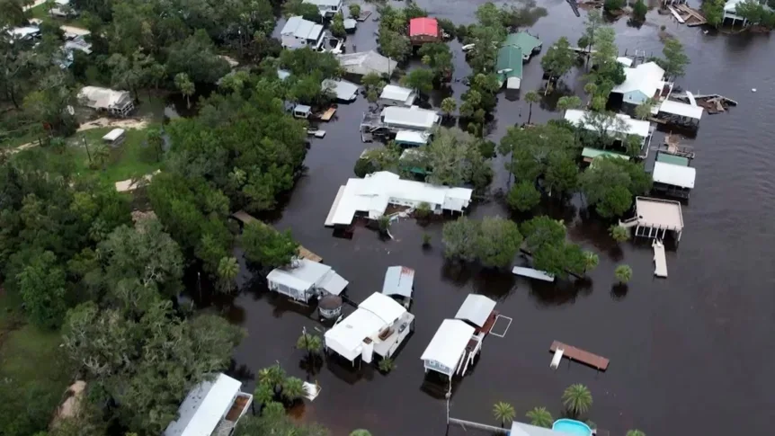
The wrath of Hurricane Idalia has left Perry, Steinhatchee, and Cedar Key with significant damage. Streets are inundated, homes and businesses have been compromised, and the local populace is in urgent need of assistance. Recent reports from the Washington Post paint a vivid picture of the evolving scenario, with emergency services tirelessly working to bring relief and support to the affected communities.
The Imperative of Aerial Surveys
In the wake of a disaster, swift aerial damage assessment is a cornerstone of the recovery process. It enables authorities to allocate resources judiciously, strategize relief operations, and make data-driven decisions about reconstruction. Traditional assessment methods, often reliant on ground-based inspections, can be protracted and might not offer a holistic view of the devastation. This is where aerial surveys, facilitated by drones, come to the fore.
Utilizing state-of-the-art drone technology, Fair Lifts can obtain high-definition images and videos of the impacted zones, offering a comprehensive perspective of the destruction. This not only accelerates the assessment timeline but also guarantees that no area remains overlooked.
Why Choose Fair Lifts for Aerial Surveys in Perry and Nearby Regions
With a storied history in delivering aerial survey solutions across diverse sectors, Fair Lifts stands as a beacon of hope for Perry and its neighboring areas during these trying times. Here’s why Fair Lifts is the go-to choice:
- Immediate Deployment: Fair Lifts can promptly cover expansive areas, ensuring that aerial damage assessment is both timely and thorough.
- Premium Data Quality: The drones come equipped with cutting-edge imaging capabilities, ensuring the data’s precision and clarity.
- Skilled Pilots: Fair Lifts boasts a cadre of certified pilots with vast experience in aerial surveys, ensuring operations are both safe and accurate.
- Custom Solutions: Recognizing the unique challenges posed by each disaster, Fair Lifts offers bespoke solutions tailored to the specific needs of Perry and its neighboring areas.
- Cost Efficiency: Aerial surveys can often be more economical than traditional methods, delivering unparalleled value while yielding precise results.
Supporting Perry’s Path to Recovery
As Perry, along with Steinhatchee and Cedar Key, embarks on the journey of recovery, having precise and up-to-date data is indispensable. Fair Lifts’ aerial survey solutions can play a pivotal role in this journey, equipping authorities with the insights they need to rebuild better and stronger.
Furthermore, the use of drones can also help identify areas still at risk, aiding in the prevention of further damage and ensuring the safety of the residents. As the community bands together in solidarity, Fair Lifts remains committed to aiding in the recovery process.
Facing the Challenges
The aftermath of Hurricane Idalia has posed significant challenges for Perry and its neighboring areas. However, with the support of innovative solutions like aerial surveys from Fair Lifts, the road to recovery can be navigated with confidence. As the community rallies in unity, it’s heartening to know that cutting-edge technology and expertise stand ready to assist in rebuilding a resilient Perry and its surroundings.
If you require more information on Fair Lifts’ aerial survey solutions in Perry, Steinhatchee, Cedar Key, and other services, please call our dedicated team at 1-800-318-8940 today.